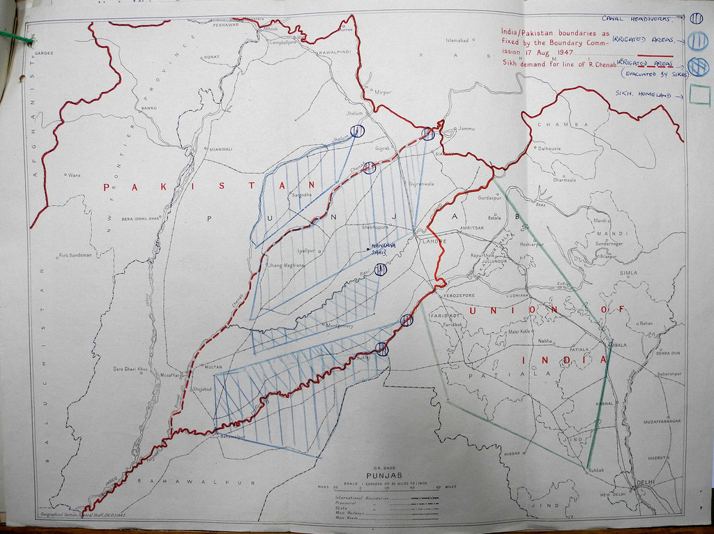
Map showing the India–Pakistan boundary as set on 17 August 1947
Image Map showing the India–Pakistan boundary, as set by the Boundary Commission on 17 August 1947, and the problem of population movements raised by the partition of British India.
Source et copyright
Source: India/Pakistan boundaries as fixed by the Boundary Commission 17 August 1947. Sikh demand for line of R. Chenab. Great Britain. Foreign and Commonwealth Office. 1947. Conservé à: The National Archives of the UK (TNA). FO - Records created or inherited by the Foreign Office, Foreign Office: Political Departments: General Correspondence from 1906-1966. POLITICAL: FAR EASTERN (F): General (61). Situation in India: preparations for the transfer of power. Code 61 File 905 (papers 2292 - 2759). 01/01/1947-31/12/1947, FO 371/63529.
Copyright: (c) The National Archives of the United Kingdom