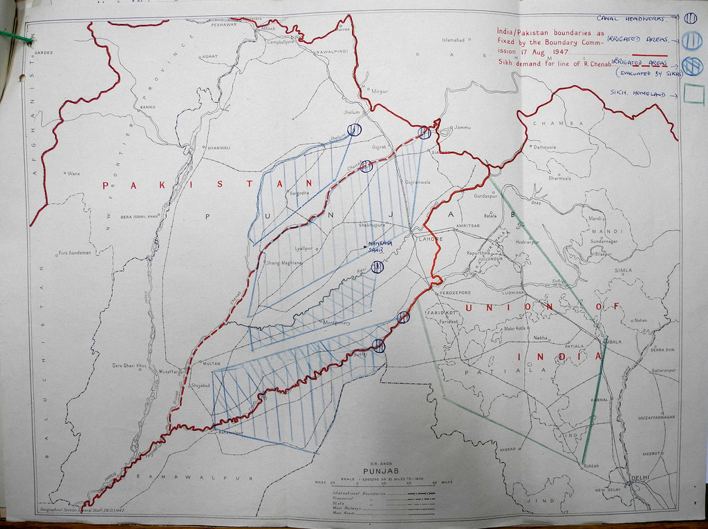
Carte de la frontière indo-pakistanaise telle que prévue le 17 août 1947
Image Carte montrant la frontière indo-pakistanaise, telle que fixée par la Commission des frontières le 17 août 1947, ainsi que le problème des déplacements de population lié à la partition de l'Inde britannique.
Source et copyright
Source: India/Pakistan boundaries as fixed by the Boundary Commission 17 August 1947. Sikh demand for line of R. Chenab. Great Britain. Foreign and Commonwealth Office. 1947. Conservé à: The National Archives of the UK (TNA). FO - Records created or inherited by the Foreign Office, Foreign Office: Political Departments: General Correspondence from 1906-1966. POLITICAL: FAR EASTERN (F): General (61). Situation in India: preparations for the transfer of power. Code 61 File 905 (papers 2292 - 2759). 01/01/1947-31/12/1947, FO 371/63529.
Copyright: (c) The National Archives of the United Kingdom